Measured by NuaSense weather stations and soil probes on Kenyan farms, over the period stated with each figure. Past readings, not a forecast.
One probe, three, or one per block: the choice as it reaches the phone
The question comes in as a quote. A supplier has put one soil sensor on every irrigation block, the total is more than the grower bargained for, and what he types into his phone is this: how many soil moisture sensors does a field really need? No published source gives a count per acre, per hectare or per block. Whatever number a salesperson quotes you is a sales number. Build the answer from three things you can check on your own ground instead: how many soils the block actually holds, which way the water moves across it, and how far the readings have to travel to reach a signal.
Four options make sense on a Kenyan block. The first is to bury nothing and work with a spade, a handheld meter and a notebook. The second is one probe, set carefully in the soil that covers most of the irrigated area. The third is a small set of two or three, placed along the path the water takes or one for each soil type you can see. The last is one per irrigation block, which is where most quotes start and where most of them should stop.
Every option costs you something and buys you something, and what it buys is not always what the brochure promises. Putting a second probe in the same soil does not make the first one more accurate. A probe at the far end of a long shamba may need a second radio mast before it needs anything else. And however many you bury, a probe sitting in a bed of heavy manure reads worse than one in mineral soil.
The soil boundary decides before the acreage does
The best evidence that probe count is really a soil question comes from a field that was meant to be uniform. In the comparison of sensor-based and weather-based scheduling published through AGRIS, Decagon GS-1, Acclima TDR-315 and Watermark 200SS sensors were installed at several locations in a soybean field in Mississippi and a cotton field in Missouri, reading hourly at different depths. At the Missouri site every sensor sat within the same Tiptonville silt loam map unit. Even so, some readings looked like they came from sandier ground, and the authors say outright that the variable soils made the sensor values hard to interpret.
That is an American field, well surveyed, with a named soil series. A Kenyan block gives you far less to work with. The texture and water holding figures a dashboard shows for your location come from modelled baselines such as iSDA Africa at 30 m resolution, or SoilHive built on SoilGrids, fetched once and of roughly 2016 vintage. Those are map values, not a soil test of your field. If a named map unit in Missouri could hide sand patches enough to change how a probe should be read, then a 30 m modelled pixel in Nakuru or Kajiado will hide them too. Treat the pixel as proof that one probe speaks for the whole block at your peril.
The FAO guide to field measurements for surface irrigation comes at the same point from the other side. It says it is worthwhile to record where the major soil types in a field are and how far they spread, and that this may need sampling and laboratory analysis. A grower with a phone can do something cheaper. After an irrigation, walk the block and mark where the surface dries first, where water ponds, where the ridge looks paler, where the old channel used to run. Every patch you can see and name is a candidate probe site. If a block has one soil you cannot split by eye, it is a one-probe block until a reading proves otherwise. A block with a visible sandy shoulder and a heavier bottom is already a two-soil block. The count follows the soils, not the acres.
Borrow the FAO stake lines for the layout
Once you know the soils, the next question is where along the block the probes should sit, and here a document written for another job beats anything written about probes. The FAO field measurements chapter on evaluating surface irrigation sets out one to three lines of stakes spaced 20 to 30 metres apart, or enough stakes to measure five to ten points along the expected line of water flow. A border or basin needs at most three lines. A furrow system may need as little as one, depending on how uniform the topography is. For each point the survey records the distance from the field inlet, along with the field length in the primary direction of water movement and the field width.
Read that for what it is. It describes a stakes-and-tape survey done once to evaluate a surface irrigation system, not a plan for permanent buried sensors. Five to ten points is a day's work with a handheld meter, not a purchase order. Still, the logic carries straight over. Water on a block moves in a direction, and the spots that matter lie along that direction rather than spread evenly across the area. On a furrow-irrigated block of maize or onions in Kenya, the head and the tail of the furrow are the two places that behave differently, and a probe halfway along tells you about neither. On a drip block the flow runs from the pump along the laterals and pressure drops as it goes, so the near end and the far end are again the two positions worth comparing.
That is why the third option lands at two or three probes instead of a grid. One probe sits where the water arrives first, another where it arrives last, and between them they bracket the block. If there is a soil type that neither of those two sits in, the third goes there. Past that, you are only paying to confirm what the first two already told you.
Where the first probe goes
If the budget only stretches to one probe, where you put it matters more than which brand you buy. The University of Arizona Extension guidance on soil moisture sensor selection records that the most common installation depths run from 0.15 m to 1.5 m. It also records that a sensor's volume of influence ranges from 0.1 to 1.0 litres, with a larger volume being better, and that installation should disturb and remove as little soil as possible. That way the soil around the sensor stays like the original and air gaps do not produce faulty readings. A litre of soil is a small thing. So the first probe has to sit in a litre that stands for the block.
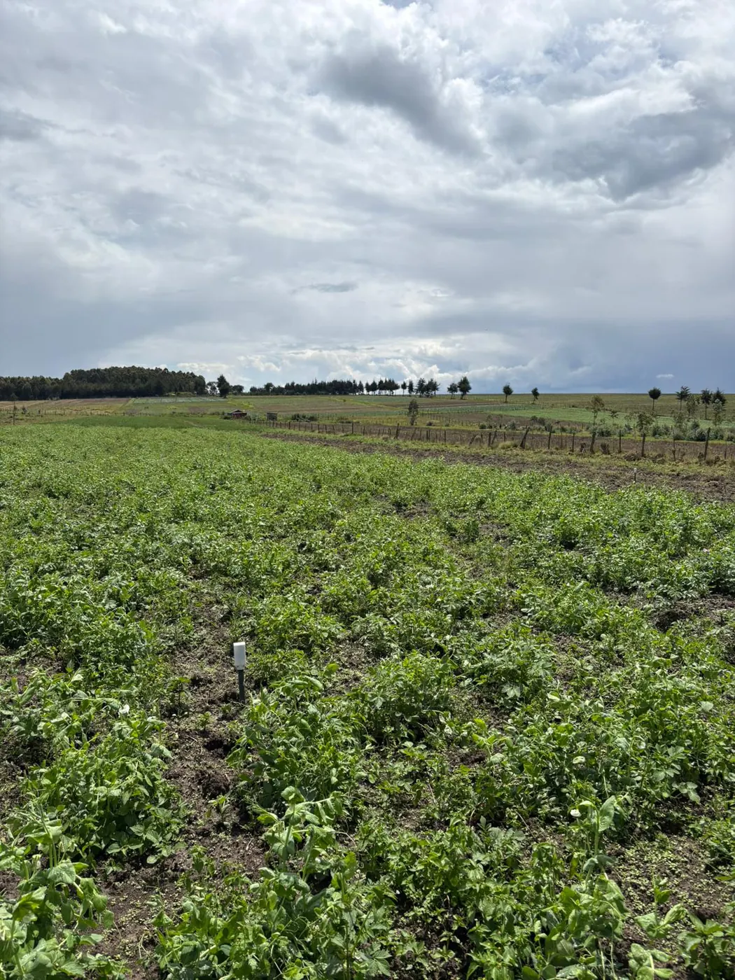
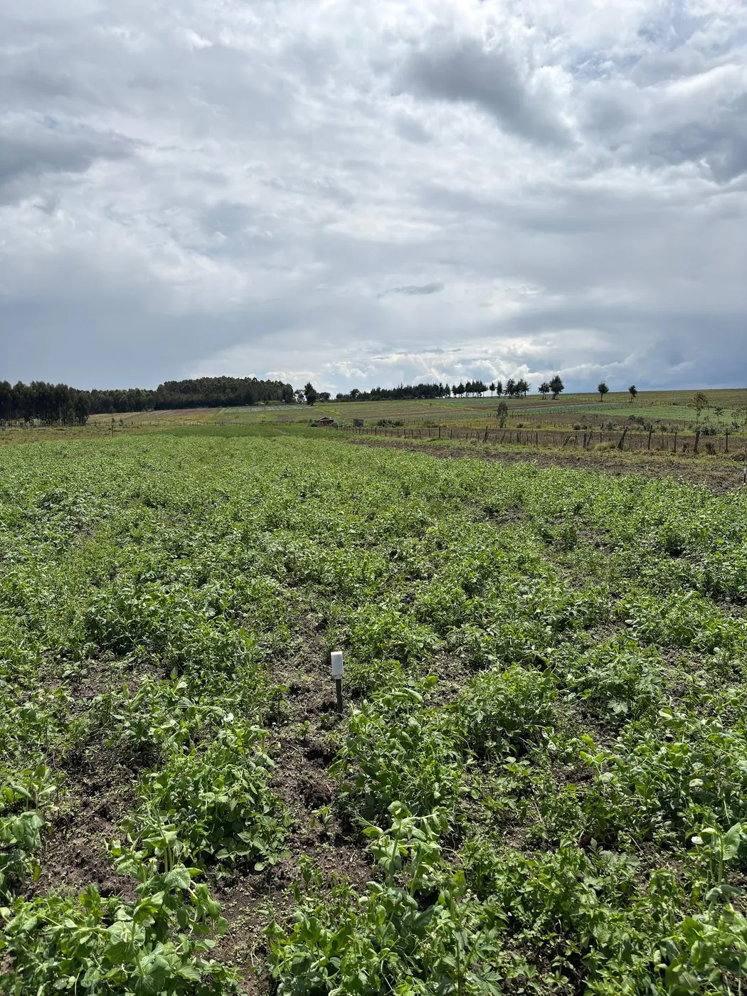
That comes down to three choices, made in order. First the soil type: put it in the texture that covers most of the irrigated area, not the sandy corner that worries you and not the heavy bottom that stays wet. Second, horizontal position relative to the water: inside the wetted zone of the emitter or the furrow, in the part of the flow line the bulk of the crop experiences, not at the extreme head or tail. Third, depth: where the active roots of the main crop are, picked for that crop. That is why NuaSense sensors are buried at a depth set per installation rather than at a published centimetre figure. Each sensor carries a shallow probe and a deeper probe, and each depth reports moisture and soil temperature.
The two depths do not behave alike, and our own network shows how far apart they go. Across 15 NuaSense soil probes over 02 October to 01 November 2026, the steadier of the two depths moved through 2.6 °C in soil temperature. The more variable one moved through 12.2 °C. Divide one by the other and the more variable depth swung about 4.7 times as far. Moisture at the two depths separates the same way after rain or irrigation, the wetting front reaching one before the other. A single sensor with two depths is in effect two probes stacked. For a block getting one probe, that vertical pair is often worth more than a second sensor a few metres away in the same soil.
Three readings in a triangle, before you pay for a second probe
A low-cost handheld sensor can answer the count question before any probe is buried, and the method comes from a calibration study. The Frontiers study developing a low-cost handheld soil moisture sensor calibrated its LCSM device against 408 soil samples from 83 locations, 70 of them mineral soil sites yielding 301 samples and 13 organic soil sites yielding 107. At each location the researchers took three LCSM readings in a triangular configuration and averaged them against a gravimetric sample cored from the centre. The handheld agreed with commercial HydraProbe and ThetaProbe sensors at R above 0.90.
The triangle was designed to average out small-scale noise so the calibration would be fair. Turned around, it becomes a cheap test of how noisy your own block is. Pick the spots you are considering for probes. At each spot, on the same morning, take three handheld readings in a small triangle and write them down. Then look at two spreads. If the three readings within a triangle differ as much as the averages differ between spots, the soil is patchy at the scale of a metre. A buried probe anywhere will then represent only its own patch, and more probes will not fix that; a well-placed single one plus a spade is the honest answer. If the triangles are tight but the spots differ, you have zones, and each zone is a candidate for its own probe.
Two cautions. The study used three readings to calibrate a handheld; it did not recommend three buried probes per block. And a handheld reading and a buried reading are two different measurements even in the same bed, for reasons the earlier piece on meter readings against buried probes set out: different scales, different volumes, different times of day. Use the handheld to map the variation, then settle the count.
An extra probe buys coverage, not accuracy
Behind a four-probe quote sits a common misunderstanding: that more probes make the moisture figure more trustworthy. They do not. Accuracy comes from calibration, and the Frontiers study puts numbers on it. Its generalized calibration for mineral soils gave an RMSE of 0.035 m3/m3 with a bias below 0.001 m3/m3 and R of 0.90. Soil-specific calibration pulled the RMSE down to 0.031 m3/m3 for loam and 0.034 m3/m3 for sandy loam. The study notes that past work reports RMSE under about 0.04 m3/m3 for popular dielectric sensors, and it recommends site-specific or soil-specific calibration where higher accuracy is wanted. A second probe in the same loam carries the same error as the first. Only a calibration against that loam shrinks it.
A second probe buys you a second place to look. Suppose the Missouri silt loam had sand pockets in it. No amount of calibration on the loam would have shown the grower what the sand was doing. Only a probe sitting in the sand could tell him. So the test for whether a probe is worth adding comes down to space. Does it sit in a soil, a spot on the flow line, or a depth the existing probes don't already cover? If it does, it buys information. If it sits in the same soil at the same position, it buys reassurance. That's pleasant, and not worth seven thousand shillings.
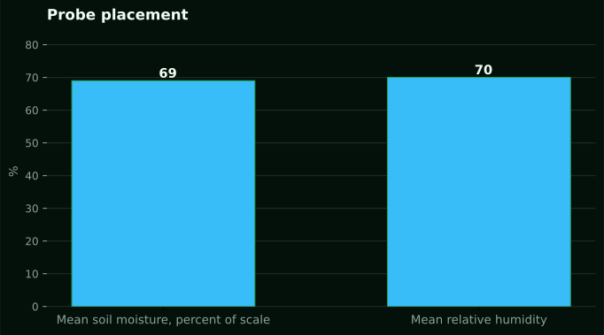
One soil is a special case, and Kenyan horticulture meets it often. In the Frontiers study, the forest organic soil gave an RMSE of 0.078 m3/m3 and a correlation of only 0.80, about double the error on mineral soil. A greenhouse bed built up with manure and compost over several seasons behaves more like that organic soil than like a field loam. The Arizona guidance adds that capacitance sensors should be calibrated for sandy, loamy or clayey soil, and for saline conditions. Our LoRaWAN probes report relative moisture as a percent of sensor scale, not calibrated volumetric content, with readings of 60 to 85 normal on that scale. Across 15 probes over October 2026 the network averaged 69 percent of scale, and most readings sat between 42 and 86. On a scale like that, the work is watching the rise and fall in one spot. A probe in organic or salty soil still tracks. But read the number against your own wet and dry marks, never against a table. That is also why the study's note on gravimetric sampling matters. Weighing soil wet and dry is the most reliable method, but it takes labour and cannot be done continuously. So the spade sets the marks, and the probe watches between them.
The four options side by side
Here is the comparison that should have come with the quote. These are the only prices NuaSense publishes, and they exclude taxes. Sensors also need a weather station to reach the internet. That same station is the hardware recording rainfall, wind, temperature and humidity on the mast.
- Buy nothing buried | Cost: a handheld meter if you want one, otherwise a spade and your time | Buys: a map of where the block is wet and dry on the mornings you walk it, and the triangle test above | Right call for: a single hand-watered plot in one soil, or any block you have not yet walked after irrigation
- One buried sensor, two depths | Cost: a NuaSense soil sensor at KES 7,000, or KES 9,000 for two moisture and two temperature channels, plus the KES 30,000 weather station that carries its readings, Safaricom data passed on at cost at about one US dollar a month, dashboard free | Buys: a continuous trace every ten minutes at a shallow and a deeper depth in the soil that covers most of the block, and a check on how much of each rain and irrigation arrived at the roots | Right call for: a drip block of one main crop on one visible soil texture
- Two or three sensors along the flow line | Cost: each added sensor at the prices above, on the same station if within radio reach | Buys: head and tail of a furrow run, or near and far end of a drip lateral, plus one extra soil type if the block has one | Right call for: furrow irrigation, long laterals, or a block where the walk showed a clear soil change
- One sensor per irrigation block | Cost: scales with blocks, and may need a second station if the blocks are far apart | Buys: a separate trace per valve, useful only if you irrigate each valve on its own reading | Right call for: different crops with different target ranges on separately valved blocks
Two things need saying plainly. A sensor with an EC channel exists at KES 10,000, but EC is not currently streaming from the deployed fleet, so a grower buying it for salinity readings should ask before paying for that channel. And if you irrigate all four blocks on one valve for the same minutes, don't buy four probes. The fourth trace won't change anything you do. Who shouldn't buy at all? Anyone who has not yet dug a hole after an irrigation and looked at where the water stopped. That look is free, and it decides where everything else goes.
Radio range sets the plan before the hardware
Sometimes a fourth probe isn't a probe problem. Arizona Extension guidance records an average communication distance of about 0.5 km from a wireless sensor to its station or repeater, with stations broadcasting up to about 10 km or to the nearest cell tower, battery life of 3 to 15 years, and sampling intervals from 10 minutes to one hour. Those figures come from a market analysis of products sold in the United States. None of it is guaranteed on a Kenyan farm with gum trees along the boundary, maize at full height between probe and mast, or a ridge in the way.
The transfer here is a planning rule. Draw your blocks, mark where the mast would stand, and ask whether every probe position sits within comfortable line of sight. On a compact drip farm the answer is usually yes, and the count becomes a soil question only. On a scattered farm with a block across the road, the far probe may need its own station. A station costs more than four sensors. The honest arithmetic then favours a single probe on the near blocks and a handheld on the far one. On NuaSense hardware the sensors report roughly every ten minutes over LoRaWAN to the solar-powered station, which reaches the internet over a Safaricom SIM or Wi-Fi. There is no separate gateway to buy.
Use the probe to check what the rain actually did
One job a single probe does well is showing how much of a rain or an irrigation actually reached the roots. The AGRIS comparison found that the Arkansas Irrigation Scheduler, a weather-based water balance, assumed more water entered the soil than the sensors showed, from both irrigations and from rainfalls under 25 mm. The authors concluded that both approaches could be used, with close attention to soil texture and to the effective portion of rainfall or irrigation. That scheduler is an American tool, so what transfers is the mechanism. Any method starting from a gauge figure has to guess how much of a small shower got past the canopy and the crust. A probe doesn't guess.
Our own network, 02 October to 01 November 2026, shows how uneven the input side is. Station totals ranged from 0.0 mm to 118.4 mm across 12 NuaSense weather stations in Kenya. That is a spread between separate farms, not a regional figure. And only 550 of 22,596 ten-minute readings, 2.4 percent, recorded any rain at all. For the count question, this cuts one way. The gauge is on the mast, one per farm. The probe that checks whether a shower changed anything at root depth needs to be in the soil most of the crop grows in, and one such probe answers for the block. The earlier post on the moisture range each crop wants covers how to read the level itself; this piece is only about where and how many.
Start with one, add the second only when the soil says so
So you want a straight answer. For most Kenyan drip and furrow blocks growing one crop on one visible soil, go with a single sensor that reads at two depths. Put it in the main soil type inside the wet zone. Pick the spot after walking the field and taking a triangle of handheld readings, not from a map pixel. You add the second sensor only when you need it, not before: it goes in if the walk turns up a different soil, or if the head and tail of a furrow act differently enough that one trace misleads you at the other end. One sensor per block is right only when the blocks have different crops and separate valves.
Honestly, saying don't buy anything is right more often than any sensor company will admit. If you're on one plot and water by hand, the spade and a notebook will teach you most of what a probe would, and your money is better put into the drip kit itself. The NuaSense overview of smart irrigation in Kenya covers that side, from low-cost drip kits and gravity-fed systems to solar pumping. If you do decide to buy, the soil moisture sensor page explains what the two-depth probe reports and what it doesn't. And if the quote on your phone says four and nobody has walked the block, send it back.